
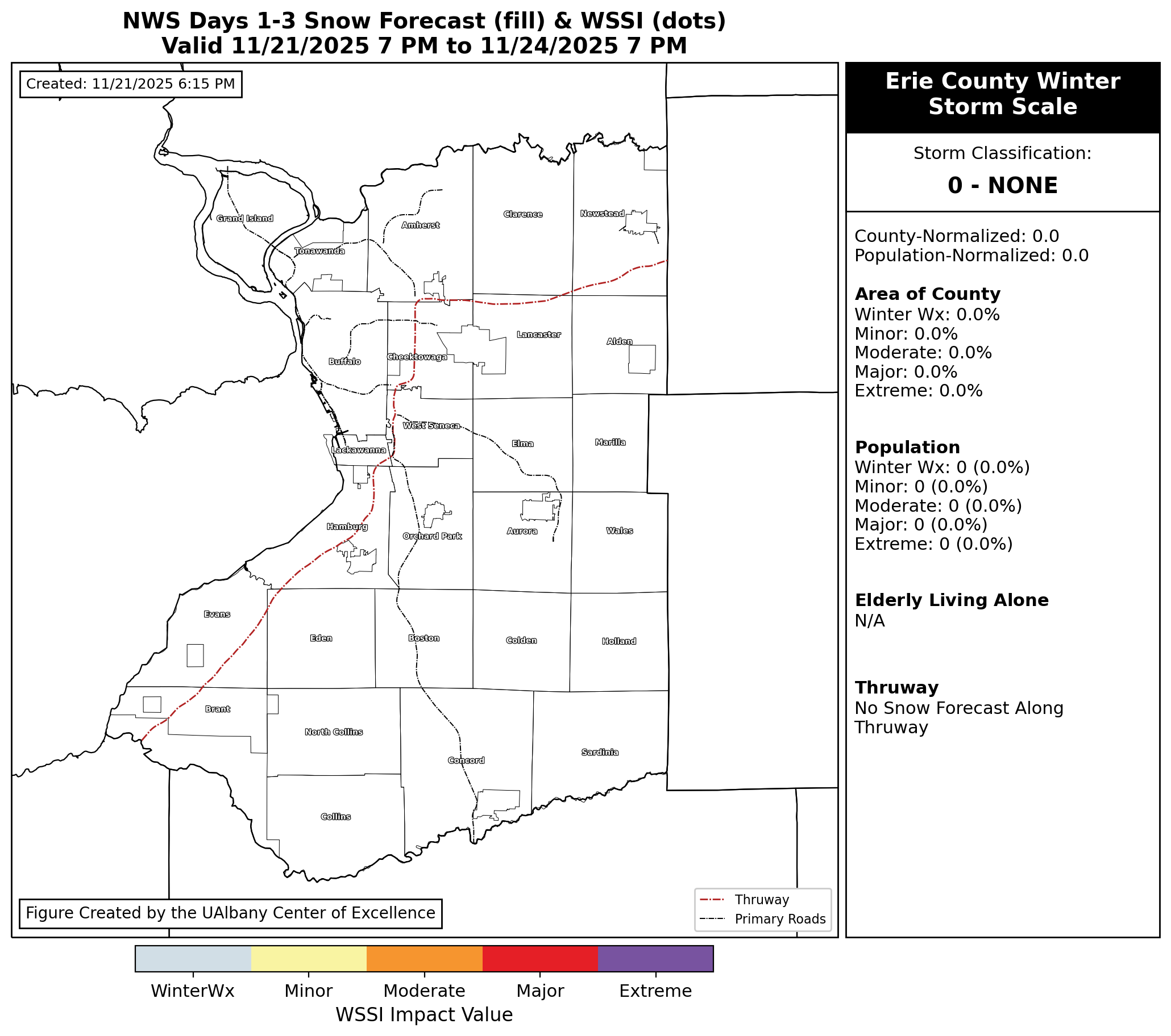
The Erie County Winter Storm Scale (ECWSS) presents a real-time map of winter weather-related impacts to people (by demographic) and places within Erie County, New York.
ECWSS utilizes the Winter Storm Severity Index (WSSI) produced by the National Oceanic and Atmospheric Administration (NOAA), updated at approximately :15 past the hour using the latest available NOAA data.
Latest Days 1 - 3 ECWSS (click to enlarge):
If images appear out of date, try clearing your browser's cache.
Website and Figures Developed by Matt Seymour
Research Support Specialist, Center of Excellence in Weather & Climate Analytics, University at Albany
Please contact Matt (mseymour2@albany.edu) or Nick Bassill (nbassill@albany.edu) with any questions regarding the website or its contents.
Header Image Source